


A predictive flood map for your neighborhood
Wall Street spends huge on predictive models. So does the military.
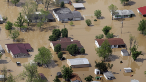
So why doesn’t Washington even try to predict the extent of flooding in Louisiana?
 When updated flood maps for the New York City region were created in 2013, residents were shocked to find the flood zone had expanded to include double the number of houses and businesses since the maps were produced less than twenty years before. This change was driven by new data from Hurricane Sandy, which flooded a growing area.
But the new maps still weren’t looking ahead, just back at a recent disaster. If FEMA isn’t going to start telling us what properties will be threatened by warming in the future, at least NOAA let’s us do it for ourselves. You may be surprised by what you see with their free mapping tool.