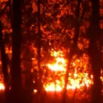


Severe drought shows the past – and the future
Drying rivers are showing us our history.
Do we see what they’re showing about our future?
At least archeologists and historians can take advantage of severe drought.
 With parts of the Mississippi and Missouri Rivers at their lowest levels in decades, many sunken objects are being uncovered. This World War II minesweeper, a museum ship in St. Louis, was lost years ago, ripped from its moorings by flood waters. Now we know where it ended up.
What appears to be a thousand-year-old map carved on a boulder has also surfaced. The AP story quotes Steve Dasovich, an anthropology professor at Lindenwood University. “It appears to be a map of prehistoric Indian villages. What’s really fascinating is that it shows village sites we don’t yet know about.”
The rock was originally on dry land, but the Mississippi changed course to submerge it.
The risk of drought varies widely from state to state – even county to county – across the US. What’s the risk in your hometown? Soon you will be able to check drought risk in our free Where-To-Live Scorecards, to be published in the New Year.