


Your Social Vulnerability Index – make disasters less disastrous
Will your hometown find it extra costly
to recover from the ravages of global warming?
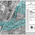
 When it comes to disasters – storms, flooding, and health hazards – some hometowns are more vulnerable than others. Physical vulnerabilities can be obvious. If your town is close to the coastline, in a floodplain, on the tornado or hurricane tracks, or without a reliable water source, your long-term costs from a warming atmosphere will be higher.
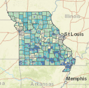
But other vulnerabilities are less obvious and can still ramp up costs from climate change in your town. Certain social conditions, including high poverty, low percentage of vehicle access, or crowded households, affect the community’s ability to prevent human suffering and financial loss in the event of disaster (and to keep relief costs low). The federal Department of Health has rated every county in the US on these and 11 other social factors, producing a Social Vulnerability Index, one of the measures included in our Where-To-Live Scorecards.
As you’d expect, the SVI map shows great disparities over very short distances. The Index was compiled to help disaster planners, but its maps and data are available to anyone who has the foresight to do a little disaster planning of their own – or to look for a more climate-proof hometown.
Where does your town fall on the Social Vulnerability Index?